An On-line Journal of My Kayak Adventures in Eastern Virginia
Showing posts with label South Hampton Roads. Show all posts

Sunday, May 28, 2017

Western Branch Reservoir - 5/28/17

     The Western Branch Reservoir is in the city of Suffolk, Virginia, and is one of several lakes that the city of Norfolk owns and uses to supply its municipal water. I don't normally paddle lakes, and usually find them less dynamic than a river or something tidal. However, this was a pleasant paddle. The surrounding shoreline was lush and green from all the recent rains, and bird song filled the air. The concrete boat ramp has plenty of parking, freshwater, and porta-johns. I put in to the side of the ramp on a sandy bank. I paddled left (east) and followed the shoreline turning into a cove that had a few houses. Heading across the main channel I entered another cove where there were no houses, and the banks were covered in a thick diverse forest of maples, birch, oaks, and beech. The cove was serene, quiet, and very green. I was about 2-3 weeks late to see all of the mountain laurel in bloom, but I've made a note for next year. I have also made a note to paddle this place in the fall; judging from the number of trees, the colors must be good. Following the shoreline opposite the boat ramp, I passed by a small island that could be explored on another trip, and I headed to the Lake Prince dam. This part of the paddle was the only place I encountered any current. As I paddled it, the trip was about 4 miles; I would have gone further, but rain threatened.

Swamp Rose (Rosa palustris)

Swamp Rose (Rosa palustris)


Looks like a good place for after-paddle beverages.


Wooded Cove

Wooded Cove

Wooded Cove

Wooded Cove
Lake Prince Dam

Lake Prince Dam

Boat Ramp


Thursday, July 17, 2014

Northwest River - 7/17/14

     This was my second paddle on the Northwest River. My first was during the fall when the colors were near peak. For this trip the colors were only clear sky blue and leafy green. My put-in point was Bob's Fishing Hole, right on the river. This enterprise rents Jon boats, sells bait, runs fishing tournaments, and has several ramps which they let kayakers use for only $2. Bob's is easy to get to, and is right next to busy 168, which connects Hampton Roads to northeast North Carolina and the Outer Banks. I mention this because I was never able to get completely away from the noise of this artery, and when you factor in the fighter jets roaring overhead, and the occasional train, my day with nature was not ideal. However, the river was lovely with all the bright green foliage and beautiful sky reflecting in the near-black water. I did not see much in the way of wildlife, though turtles were abundant, and I was thrilled to get pretty close to a pileated woodpecker.

     I left the landing, turning west (right) and crossed under a railroad bridge, then under highway 168. The river forks here in several places, and I took the most southerly (left) fork, figuring this would get me away from the noise of traffic, which indeed eventually got better. There are several side creeks you can explore, but the further in you go, the more likely you are to encounter fallen trees, and while you are on this river, you probably don't want to get out of the kayak. There is no firm ground except at the landing, and the rest of the land is a flooded forest. I was able to take one of the cut-throughs and explored the other forks before returning to Bob's. As I paddled it, my trip was about 5 miles. If I return, I will probably head in the opposite direction to get even further away from the noise, but I suspect I will encounter more boat traffic as the river widens as it heads east.

Bob's Fishing Hole is right next to railroad tracks.

Rte. 168 Bridge
Stars and Bars


Hibiscus moscheutos

View Northwest River 7-17-14 in a larger map

Sunday, June 9, 2013

Broad Bay/First Landing - 6/9/13

     I am not sure why it took so long, but this trip was my first time kayaking in Virginia Beach. In deciding where to go I went with the familiar and chose the boat ramp at the end of 64th St. in First Landing State Park. After paying $5 at the gate, I headed towards the ramp, but knowing there was a nice sandy beach near the parking area, I launched from there. Even at an early hour there were only a couple of parking spaces left, and by the time I got back from my trip people were parking on top of each other. This kind of crowd should be expected on summer weekends.

     Once in the water I stayed fairly close to shore as this area is sort of a choke point with lots of converging boat traffic. I headed north (right), and I quickly found out not to get too close to the rip rap between the beach and the boat ramp, the rocks extend into the shallow water farther than you might think. Once past the boat ramp the water broadens, and by following the shoreline I could stay well away from any motorized traffic. Since the land is part of First Landing it remains natural and undeveloped, making it quite different from the rest of Broad Bay. The shoreline here is really quite beautiful with a mix of marsh, forests with large trees, beaches and sandy bluffs. Often when I kayak there are few places where I can pull out and stretch or explore the bank, not so here, there were many opportunities. One of the places I explored was a beach where large live oaks (one of my favorite trees) grew right next to the bay draped with Spanish moss, which is at its northerly limit in First Landing.

     I paddled all the way to Long Creek, where I explored a small creek leading to White Hill Lake, before heading back to the boat ramp and beach area. As I paddled it, the trip was about just under 4 miles. During the time I was gone the beach had grown crowded, and many boaters had pulled their crafts up onto the sand. It had become kind of a drunken tailgate party, only there were no trucks, just boats. The atmosphere on the beach was not my cup of tea, but it was worth putting up with to get to all the other places, and I would do it again.


View First Landing 6-9-13 in a larger map

Sunday, February 3, 2013

Lafayette River - East of Granby St.

     To access the upper third of the Lafayette River, the best place to put in is likely the Haven Creek boat ramp. Head towards the mouth of the creek and turn right (east) to go under the Granby St. Bridge. Following the shoreline, you will eventually reach the Virginia Zoo. The riverbank here has been left in a fairly natural state and there are usually good opportunities to see native wildlife, and if your lucky you might hear more exotic creatures as well. Past the zoo you can head towards the 26th St. Bridge. I have not been much beyond this bridge as the river narrows and becomes more shallow, so know what the tides are doing.

     Reverse course and follow the opposite shore heading towards the Willow Wood Bridge. You will soon see a local landmark, a smaller replica of the Statue of Liberty. There are several small creeks before and after the bridge you may want to explore. Mostly they are lined with houses, but there are a few spots that remain more natural. There is a treeless point that juts out into the middle of the river, just before  you reach Wayne Creek. If you turn right here, you can follow a cut-through that will take you between the Lakewood neighborhood and a large marsh, and that is also an alternative way to get to Wayne Creek. I have always seen many egrets and herons in this marsh.

     Wayne Creek is larger than the other creeks off of the Lafayette, and it will lead you to Lakewood Park, where several different rowing organizations put in.  Past the park the river heads east towards the Tidewater Dr. Bridge. I have never been beyond this point and usually turn around here. Back at the mouth of Wayne Creek, you could turn right (north) to explore more of the Lafayette. Although there are many homes and docks here, this end of the river is pretty quiet. Heading back, immediately past the Willow Wood Bridge and just before the Granby St. Bridge, there is a very new oyster reef installed by the Elizabeth River Project. This end of the Granby St. Bridge is popular with shore fishermen, so mind you don't run into someone's fishing line. You can cross the river here and head back to the Haven Creek boat ramp. As followed, this trip is a little more than 7 miles.

Reel Estate

Many creatures enjoy living along the Lafayette.
Bird on a Pole

The 26th St. Bridge
26th St. Bridge


Broken Dock


Boat Barm

Lady Liberty, South

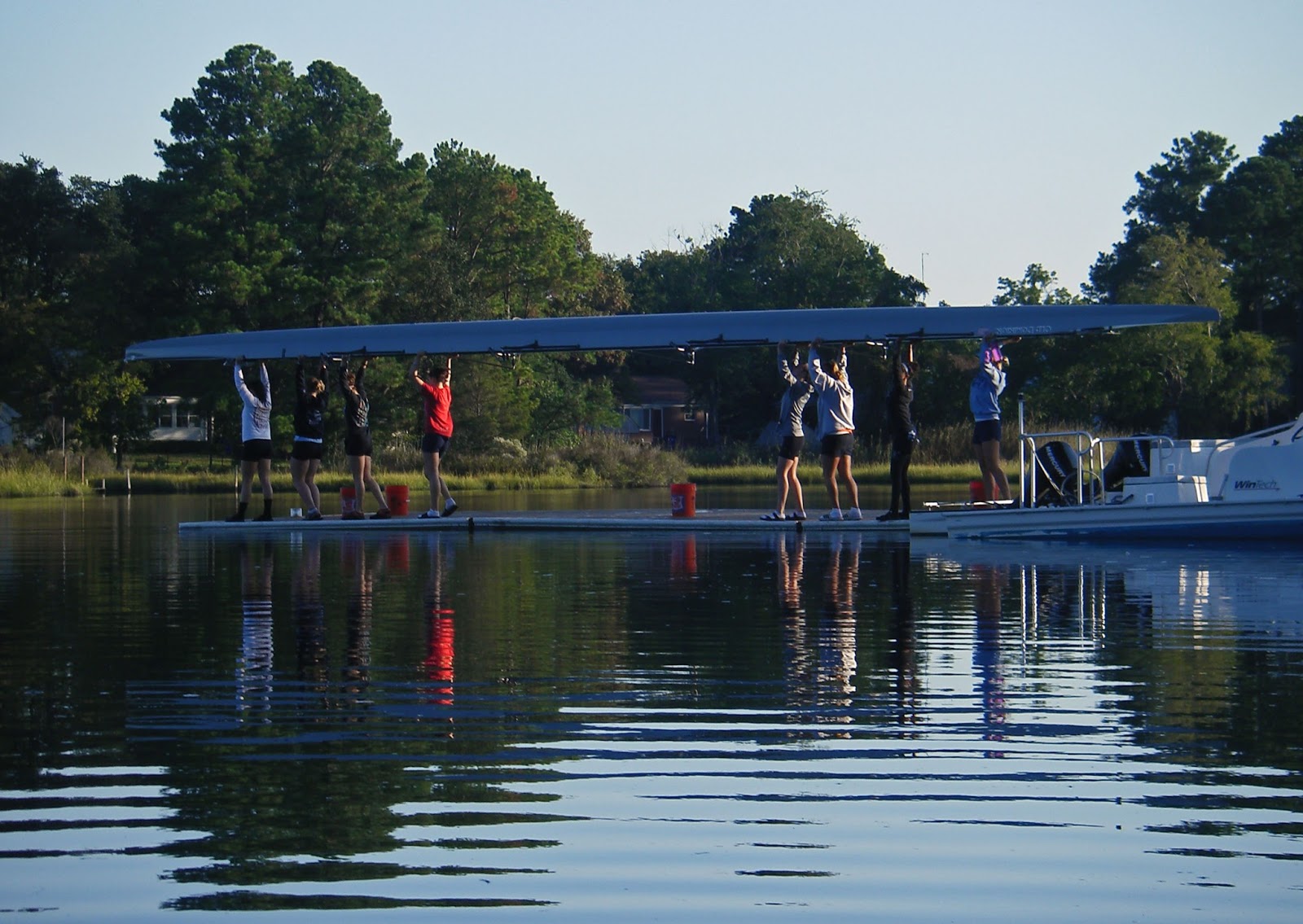
Women's Rowing Crew at Lakewood Park

People Visiting the Site of a New Oyster Reef


Lafayette River - Talbot Hall to the Granby St. Bridge

     To paddle the center section of the Lafayette River, you can either put in along Mayflower Rd. at one of the steps, at the Haven Creek ramp, or at the 45th St. ramp on Knitting Mill Creek.  Knitting Mill Creek was so named for, of all things, a knitting mill. For its small size, this can be a busy creek with a lot of boat traffic, but being an adhered to no-wake zone, kayaks are fairly common and safe.  Be careful at the mouth of the creek and avoid going between the no-wake sign and the little spit of land on the west side of the creek, especially at low tide. There is a pile of submerged, crusty rocks that you don't notice until you hear them scarping the bottom of your kayak.  Once you get out into the Lafayette, bear left (west) toward the Colley Ave. Bridge.  The bridge crosses over Colley Bay, which leads to Old Dominion University. I have never seen any boat traffic beyond the bridge, and it is usually a good place to see birds. Back out in the river, you can head north towards Carroll Place where there is a particularly nice group of houses. After Carroll Place, keep heading north until the river takes a distinct left turn, and at this point turn right to cross to the far shore in the direction of Crab Creek.

    At the entrance to Crab Creek sits Talbot Hall, one of Norfolk's oldest homes. The historic house is hard to see from the seat of a kayak because the rip rapped bank is high here. Just south of Talbot Hall there is a small creek, easily missed, with a firm sand bar at its mouth. As there are few places along the river to get out and stretch, you may want to take advantage, plus it is one of the more natural areas on the river. Continue heading south along the shore, and at some point the river will make another turn and the Granby St. Bridge will come into view.  Between Talbot Hall and the bridge are about half a dozen creeks you may want to explore, all of them lined with houses. The people are friendly, always wave, and if you are lucky you might get invited to cocktails.

     The Granby St. Bridge is a safe place to cross the river, as all the boat traffic is forced to slow down and enter the designated channel. Underneath is a popular-with-locals fishing pier that faces due east, and I have gotten many good early morning photographs here. Once you are back on the south side of the river you will see the entrance to Haven Creek, which ends at the boat ramp. Haven Creek is basically a drainage ditch for much of west side Norfolk, and in late summer you would not want to fall in the fetid water. However, the city of Norfolk has recently replaced one of the rip rap shorelines with a living one. By re-engineering how the water flows and replanting the bank with native grasses and other plants, this should hopefully improve the water quality.  Once you are back out in the river, keep heading west along the Mayflower Rd. seawall. This is one of the few places where the public has access to the river's views. I find it surreal to be paddling next to it while bikers, joggers and strollers are going by just over my shoulder. I usually see some of my neighbors here. The seawall will take you right back to Knitting Mill Creek, making the trip about 6.5 miles.  If you have worked up a thirst, but were not offered any cocktails, O'Sullivan's is quick walk from the boat ramp.

Chris on Colley Bay with a Great Egret

Talbot Hall
Talbot Hall (2)

Hard to Tell You Are in the Middle of the City

Under the Granby St. Bridge
Layfayette 9-15-12  (6)

Near the Seawall
Jet Trail Morning (3)


View Lafayette River - Talbot Hall to the Granby St. Bridge in a larger map

Lafayette River - Tanner's Point to Crab Creek

     The first third of the Lafayette River will take you through some of Norfolk's wealthier neighborhoods. If you appreciate eclectic residential architecture, peering into other people's backyards or looking at their boats, then this will be an enjoyable paddle for you. I usually put in at my normal spot on Mayflower Ave. and head towards the Hampton Blvd. Bridge and the mouth of the river.  Just before you get to the bridge on the south shore of the river is the old U.S. Public Health Hospital.  Now it houses naval offices, but the old architecture remains with its large cupola and over-the-water gazebo. I always find the space underneath of bridges kind of interesting, so I usually hang out here for a few minutes. If you need to cross the river, this is also a fairly safe place to do so, as all the larger boat traffic has to use the marked channel. Beyond the bridge is Edgewater Haven and the mouth of the river where it joins the Elizabeth. From this point you can watch the large cargo ships, working tug boats and the occasional naval vessel coming and going.

     The river begins at Tanner's point on the north side of the river, and this spot will give you a close view of cargo containers being loaded and unloaded.  Further east is The Hermitage, one of my favorite places to visit in Norfolk. If you turn north into Lochaven you can see the restored living shoreline on the grounds of The Hermitage. Further in you can paddle up to the base of a shingle-clad lighthouse, and there are lots of opportunities to see wildlife along the undeveloped shoreline. At the mouth of the loch is the Norfolk Yacht and Country Club, and you will likely encounter students from their sailing classes. Back under the bridge, the north shore of the Lafayette has several small creeks that are all worth exploring, especially at high tide.  The largest of these is Crab Creek, and at its entrance is a sand bar and marsh where I always see cormorants. Crab Creek is large enough that you could spend more time in it than the other creeks. If you explore everything I have suggested here, it would be about a 10 mile paddle.
Old U.S. Public Health Hospital
Old US Naval Hospital

Under the Hampton Blvd. Bridge
Hampton Blvd. Bridge

The Hermitage and its Restored Living Shoreline
The Hermitage (2)

The Hermitage (3)

The Lochaven Lighthouse at The Hermitage
The Hermitage

Pelician Take Off

Symmetry

Asymmetry

Mosaic Dolphin

Cormorants at the Mouth of Crab Creek
Cormorants for JoEllen

Old School Sailboat in Crab Creek
Masts